Latest topics
Warnings
Most Viewed Topics
Search
Tropical Teaser?
2 posters
Page 1 of 1
 Tropical Teaser?
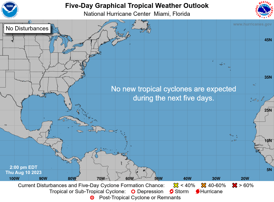
Early this morning I noticed the NHC placed a 20% yellow circle in an area of the Western Caribbean. Knowing through Climatology that area of the Caribbean is one of the most likely places for development this time of year,it has my attention. 20% is a high number in comparison to the 0%,5% and 10% numbers you normally see..That speaks volumes to me as they don't believe the models and have a seat of the pants feeling.
Now my thoughts on this system...
1st: The disturbed weather is in a favorable area for this time of the season..
2nd: Wind Shear is High in the area but I feel the shear tendency is more important giving the WNW progress I believe the area will track.
3rd: Upper level divergence and lower level convergence.
Now to put these thoughts to words and graphics so I can blow my first tropical forecast of the year:)
The disturbance is aligned with climatology so there is one plus towards development.

Now lets look at wind shear :

Shear levels are between 20 and 40 kts...But to me that is not significant because this image is not fluid, so I will rely more on the tendency at this stage in the disturbances life. So before I check the tendency I need an idea on where it's going.
Looking at the steering currents I'd say the disturbance moves WNW followed by an NW movement after 48 hours.

Now that we feel the direction we can look at the shear tendency to where the disturbance will be.

Looks like the shear increase could be temporary as shear levels are dropping by 5kts either side of an narrow area of increase along the path I feel the disturbance will take.
Lower level convergence:

Looks like convergence at the lower levels are on the rise which is conducive.
Upper level Divergence:

Looks like we have divergence aloft ..
So putting all these thoughts together I will actually give the area a little higher chance to develop than the NHC...If it does we will then watch the disturbance as it slides in to the Southern Gulf of Mexico mid week....
It's time to hurry up and wait!!..lol
Now my thoughts on this system...
1st: The disturbed weather is in a favorable area for this time of the season..
2nd: Wind Shear is High in the area but I feel the shear tendency is more important giving the WNW progress I believe the area will track.
3rd: Upper level divergence and lower level convergence.
Now to put these thoughts to words and graphics so I can blow my first tropical forecast of the year:)
The disturbance is aligned with climatology so there is one plus towards development.

Now lets look at wind shear :
Shear levels are between 20 and 40 kts...But to me that is not significant because this image is not fluid, so I will rely more on the tendency at this stage in the disturbances life. So before I check the tendency I need an idea on where it's going.
Looking at the steering currents I'd say the disturbance moves WNW followed by an NW movement after 48 hours.
Now that we feel the direction we can look at the shear tendency to where the disturbance will be.
Looks like the shear increase could be temporary as shear levels are dropping by 5kts either side of an narrow area of increase along the path I feel the disturbance will take.
Lower level convergence:
Looks like convergence at the lower levels are on the rise which is conducive.
Upper level Divergence:
Looks like we have divergence aloft ..
So putting all these thoughts together I will actually give the area a little higher chance to develop than the NHC...If it does we will then watch the disturbance as it slides in to the Southern Gulf of Mexico mid week....
It's time to hurry up and wait!!..lol

gomexwx- Posts : 641
Reputation : 63
Join date : 2012-07-16
Location : On an Acre somewhere on the gulf Coast
 Re: Tropical Teaser?
Very nice write up, Gomey..... will be interesting to watch this blob, and see how far west it goes, before getting pulled upward......

sangria- Admin
- Posts : 2345
Reputation : 55
Join date : 2012-07-16
 Similar topics
» The Atlantic Express - Tropical Storm Isaac - Tropical STorm Joyce- and New AOI
» The Tropical Wave Train
» Tropical Storm Erika
» Tropical Threats First Part of Sept
» Tropical Storm Leslie - Can you say Irene........
» The Tropical Wave Train
» Tropical Storm Erika
» Tropical Threats First Part of Sept
» Tropical Storm Leslie - Can you say Irene........
Page 1 of 1
Permissions in this forum:
You cannot reply to topics in this forum


» summer 2019 hurricane season
» April-May Florida weather and local events etc
» NASCAR 2019
» Late January through February outlook
» FLORIDA/ALABAMA AND THE HOLIDAY SEASON WEATHER
» NASCAR 2018
» CLOSED Florida/Alabama Blog - October Tropical Mischief