


CLOSED April Showers
:: Florida Blog
Page 13 of 15 •  1 ... 8 ... 12, 13, 14, 15
 ![]()
Re: CLOSED April Showers
![]() by LargoFL Tue Apr 24, 2018 12:16 pm
by LargoFL Tue Apr 24, 2018 12:16 pm

LargoFL- Posts : 10724
Reputation : 130
Join date : 2017-03-05
Re: CLOSED April Showers
![]() by BillsfaninSoFla Tue Apr 24, 2018 2:17 pm
by BillsfaninSoFla Tue Apr 24, 2018 2:17 pm
LargoFL wrote:well lawn mowed and everything cleaned up, gee what a nice day it is here.
It's not here! Very warm and HUMID.
BillsfaninSoFla- Posts : 1966
Reputation : 52
Join date : 2017-03-05
Re: CLOSED April Showers
![]() by LargoFL Tue Apr 24, 2018 2:44 pm
by LargoFL Tue Apr 24, 2018 2:44 pm
FLC085-241930-
/O.NEW.KMLB.SV.W.0024.180424T1840Z-180424T1930Z/
BULLETIN - IMMEDIATE BROADCAST REQUESTED
Severe Thunderstorm Warning
National Weather Service Melbourne FL
240 PM EDT TUE APR 24 2018
The National Weather Service in Melbourne has issued a
* Severe Thunderstorm Warning for...
Eastern Martin County in east central Florida...
* Until 330 PM EDT
* At 240 PM EDT, a severe thunderstorm was located 7 miles west of
Jonathan Dickinson State Park, or 7 miles southwest of Hobe Sound,
moving east to northeast at 15 mph.
HAZARD...60 mph wind gusts and quarter size hail.
SOURCE...Radar indicated.
IMPACT...Hail damage to vehicles is expected. Expect wind damage
to roofs, siding, and trees.
* Locations impacted include...
Stuart, Tequesta, Jupiter Island, Palm City and Hobe Sound.
PRECAUTIONARY/PREPAREDNESS ACTIONS...
For your protection move to an interior room on the lowest floor of a
building.
Large hail and damaging winds and continuous cloud to ground
lightning is occurring with this storm. Move indoors immediately.
Lightning is one of nature`s leading killers. Remember, if you can
hear thunder, you are close enough to be struck by lightning.
&&
LAT...LON 2697 8008 2697 8014 2696 8015 2696 8044
2706 8041 2727 8019 2724 8014 2703 8008
TIME...MOT...LOC 1840Z 249DEG 12KT 2701 8025
HAIL...1.00IN
WIND...60MPH
$$
Sedlock
LargoFL- Posts : 10724
Reputation : 130
Join date : 2017-03-05
Re: CLOSED April Showers
![]() by LargoFL Tue Apr 24, 2018 2:45 pm
by LargoFL Tue Apr 24, 2018 2:45 pm
stay alert there Billsfan..severe storms just to your north, these storm had a Tornado warning a lil while ago tooBillsfaninSoFla wrote:LargoFL wrote:well lawn mowed and everything cleaned up, gee what a nice day it is here.
It's not here! Very warm and HUMID.
LargoFL- Posts : 10724
Reputation : 130
Join date : 2017-03-05
Re: CLOSED April Showers
![]() by LargoFL Tue Apr 24, 2018 2:47 pm
by LargoFL Tue Apr 24, 2018 2:47 pm
FLC085-111-241900-
/O.NEW.KMLB.SV.W.0023.180424T1812Z-180424T1900Z/
BULLETIN - IMMEDIATE BROADCAST REQUESTED
Severe Thunderstorm Warning
National Weather Service Melbourne FL
212 PM EDT TUE APR 24 2018
The National Weather Service in Melbourne has issued a
* Severe Thunderstorm Warning for...
South central St. Lucie County in east central Florida...
Central Martin County in east central Florida...
* Until 300 PM EDT
* At 212 PM EDT, a severe thunderstorm was located near Indiantown,
moving east at 20 mph.
HAZARD...70 mph wind gusts and quarter size hail.
SOURCE...Radar indicated.
IMPACT...Hail damage to vehicles is expected. Expect considerable
tree damage. Wind damage is also likely to mobile homes,
roofs, and outbuildings.
* Locations impacted include...
Port Saint Lucie, Indiantown and Palm City.
PRECAUTIONARY/PREPAREDNESS ACTIONS...
Prepare immediately for large hail and deadly cloud to ground
lightning. Seek shelter inside a well-built structure. Stay away from
windows.
&&
LAT...LON 2698 8059 2711 8065 2730 8032 2697 8026
TIME...MOT...LOC 1812Z 250DEG 15KT 2705 8054
HAIL...1.00IN
WIND...70MPH
$$
DWS
LargoFL- Posts : 10724
Reputation : 130
Join date : 2017-03-05
Re: CLOSED April Showers
![]() by LargoFL Tue Apr 24, 2018 2:48 pm
by LargoFL Tue Apr 24, 2018 2:48 pm
National Weather Service Miami FL
1210 PM EDT Tue Apr 24 2018
AMZ610-630-650-651-670-671-FLZ063-066>075-168-172>174-GMZ656-657-676-
250415-
Lake Okeechobee-Biscayne Bay-
Coastal waters from Jupiter Inlet to Deerfield Beach FL out 20 NM-
Coastal waters from Deerfield Beach to Ocean Reef FL out 20 NM-
Waters from Jupiter Inlet to Deerfield Beach FL from 20 to 60 NM-
Waters from Deerfield Beach to Ocean Reef FL from 20 to 60 NM
excluding the territorial waters of Bahamas-Glades-Hendry-
Inland Palm Beach-Metro Palm Beach-Coastal Collier-Inland Collier-
Inland Broward-Metro Broward-Inland Miami-Dade-Metro Miami-Dade-
Mainland Monroe-Coastal Palm Beach-Coastal Broward-Coastal Miami-
Dade-Far South Miami-Dade-
Coastal waters from Chokoloskee to Bonita Beach FL out 20 NM-
Coastal waters from East Cape Sable to Chokoloskee FL out 20 NM-
Waters from Chokoloskee to Bonita Beach FL from 20 to 60 NM-
1210 PM EDT Tue Apr 24 2018
...MARGINAL RISK OF SEVERE THUNDERSTORMS NORTHEAST...
...WATERSPOUTS POSSIBLE ATLANTIC WATERS AND LAKE OKEECHOBEE...
This hazardous weather outlook is for South Florida.
.DAY ONE...THIS AFTERNOON AND TONIGHT
Thunderstorms: Thunderstorms are likely this afternoon and evening,
mainly north and east of the Gulf Coast. Frequent lightning is
expected. A few thunderstorms will be strong, and isolated severe
thunderstorms with damaging winds and large hail are possible,
especially over Palm Beach County, Lake Okeechobee, and the Fort
Lauderdale metropolitan area.
Waterspouts: Waterspouts are possible on Atlantic waters and Lake
Okeechobee.
Wind: Some thunderstorms will become strong with very gusty winds. A
few thunderstorms, mainly north and east of a Belle Glade to Fort
Lauderdale line, may become severe with damaging wind gusts of over
60 mph.
Hail: Some thunderstorms will become strong with small hail. A few
thunderstorms, mainly north and east of a Belle Glade to Fort
Lauderdale line, may become severe with hail to the size of quarters.
.DAYS TWO THROUGH SEVEN...WEDNESDAY THROUGH MONDAY
No hazardous weather is expected at this time.
.SPOTTER INFORMATION STATEMENT...
Spotter activation is not anticipated, but individual spotters are
encouraged to report hail and high winds to the National Weather
Service. For more information...visit the National Weather Service
in Miami website at www.weather.gov/miami.
$$
KONARIK
LargoFL- Posts : 10724
Reputation : 130
Join date : 2017-03-05
Re: CLOSED April Showers
![]() by LargoFL Tue Apr 24, 2018 2:49 pm
by LargoFL Tue Apr 24, 2018 2:49 pm
LargoFL- Posts : 10724
Reputation : 130
Join date : 2017-03-05
LargoFL- Posts : 10724
Reputation : 130
Join date : 2017-03-05
Re: CLOSED April Showers
![]() by BillsfaninSoFla Tue Apr 24, 2018 4:00 pm
by BillsfaninSoFla Tue Apr 24, 2018 4:00 pm
BillsfaninSoFla- Posts : 1966
Reputation : 52
Join date : 2017-03-05
Re: CLOSED April Showers
![]() by BillsfaninSoFla Tue Apr 24, 2018 4:22 pm
by BillsfaninSoFla Tue Apr 24, 2018 4:22 pm
BillsfaninSoFla- Posts : 1966
Reputation : 52
Join date : 2017-03-05
Re: CLOSED April Showers
![]() by LargoFL Wed Apr 25, 2018 4:14 am
by LargoFL Wed Apr 25, 2018 4:14 am
hi Billsfan..its just after 4 am wednesday morning and in looking at the radar, it seems right now there are a few showers still around your area as that weak front is leaving Florida.BillsfaninSoFla wrote:I don’t see how anything will make it down this far. ?
LargoFL- Posts : 10724
Reputation : 130
Join date : 2017-03-05
Re: CLOSED April Showers
![]() by LargoFL Wed Apr 25, 2018 4:14 am
by LargoFL Wed Apr 25, 2018 4:14 am
Today...A dry and seasonable day is in store for west-
central and southwest Florida in the wake of weak departing
cold front. Plenty of sunshine can be expected with
northwest winds and high temperatures in the upper 70s to
near 80 at the coast...and lower 80s inland.
Tonight and Thursday...The next significant amplification to
the mid/upper level pattern will begin to evolve as a strong
shortwave trough evolves out of the central plains and
across the deep south. A surface cold front will accompany
this upper level energy...reaching the Florida Big Bend
region by Thursday evening. As this next front slowly
approaches, winds shift to the west and eventually southwest
during the daylight hours Thursday.
There is very good agreement among the reliable NWP
guidance (including all members of the GEFS) that the best
combination of synoptic lift and available column moisture
associated with this next approaching system will remain to
our north and westward through Thursday. With this in mind,
will keep mention of showers out of the forecast...even for
our far northern areas through Thursday evening. High
temperatures on Thursday should reach the lower to middle
80s for locations away from the coast...with middle 70s to
around 80 closer to the water due to the wind blowing off
the still relatively cooler shelf waters.
&&
LargoFL- Posts : 10724
Reputation : 130
Join date : 2017-03-05
Re: CLOSED April Showers
![]() by LargoFL Wed Apr 25, 2018 4:16 am
by LargoFL Wed Apr 25, 2018 4:16 am
LargoFL- Posts : 10724
Reputation : 130
Join date : 2017-03-05
Re: CLOSED April Showers
![]() by LargoFL Wed Apr 25, 2018 4:19 am
by LargoFL Wed Apr 25, 2018 4:19 am
LargoFL- Posts : 10724
Reputation : 130
Join date : 2017-03-05
Re: CLOSED April Showers
![]() by LargoFL Wed Apr 25, 2018 7:54 am
by LargoFL Wed Apr 25, 2018 7:54 am
LargoFL- Posts : 10724
Reputation : 130
Join date : 2017-03-05

LargoFL- Posts : 10724
Reputation : 130
Join date : 2017-03-05
Re: CLOSED April Showers
![]() by LargoFL Wed Apr 25, 2018 8:25 am
by LargoFL Wed Apr 25, 2018 8:25 am
LargoFL- Posts : 10724
Reputation : 130
Join date : 2017-03-05
Re: CLOSED April Showers
![]() by JRnOldsmar Wed Apr 25, 2018 9:29 am
by JRnOldsmar Wed Apr 25, 2018 9:29 am
LargoFL wrote:There is very good agreement among the reliable NWP
guidance (including all members of the GEFS) that the best
combination of synoptic lift and available column moisture
associated with this next approaching system will remain to
our north and westward through Thursday. With this in mind,
will keep mention of showers out of the forecast...even for
our far northern areas through Thursday evening. High
temperatures on Thursday should reach the lower to middle
80s for locations away from the coast...with middle 70s to
around 80 closer to the water due to the wind blowing off
the still relatively cooler shelf waters.
&&
For the last week of April, I'll take 60's for lows.

JRnOldsmar- Posts : 828
Reputation : 48
Join date : 2017-03-05
Location : Oldsmar, FL
Re: CLOSED April Showers
![]() by LargoFL Wed Apr 25, 2018 10:22 am
by LargoFL Wed Apr 25, 2018 10:22 am
JRnOldsmar wrote:hiya JR yes it sure was an unusual spring for sure..really NICE outside today hereLargoFL wrote:There is very good agreement among the reliable NWP
guidance (including all members of the GEFS) that the best
combination of synoptic lift and available column moisture
associated with this next approaching system will remain to
our north and westward through Thursday. With this in mind,
will keep mention of showers out of the forecast...even for
our far northern areas through Thursday evening. High
temperatures on Thursday should reach the lower to middle
80s for locations away from the coast...with middle 70s to
around 80 closer to the water due to the wind blowing off
the still relatively cooler shelf waters.
&&
For the last week of April, I'll take 60's for lows.Was this the last shot for C & So Fla??? That's my bet. What a memorable winter/spring -- in a good way!
LargoFL- Posts : 10724
Reputation : 130
Join date : 2017-03-05
Re: CLOSED April Showers
![]() by LargoFL Wed Apr 25, 2018 11:58 am
by LargoFL Wed Apr 25, 2018 11:58 am
LargoFL- Posts : 10724
Reputation : 130
Join date : 2017-03-05
LargoFL- Posts : 10724
Reputation : 130
Join date : 2017-03-05
Re: CLOSED April Showers
![]() by LargoFL Wed Apr 25, 2018 12:44 pm
by LargoFL Wed Apr 25, 2018 12:44 pm
National Weather Service Melbourne FL
1000 AM EDT Wed Apr 25 2018
AMZ550-552-555-570-572-575-FLZ041-044>047-053-054-058-059-064-141-
144-147-252300-
Flagler Beach to Volusia-Brevard County Line 0-20 nm-Volusia-
Brevard County Line to Sebastian Inlet 0-20 nm-
Sebastian Inlet to Jupiter Inlet 0-20 nm-Flagler Beach to Volusia-
Brevard County Line 20-60 nm-Volusia-
Brevard County Line to Sebastian Inlet 20-60 nm-
Sebastian Inlet to Jupiter Inlet 20-60 nm-Inland Volusia County-
Northern Lake County-Orange-Seminole-Southern Brevard County-
Osceola-Indian River-Okeechobee-St. Lucie-Martin-
Coastal Volusia County-Southern Lake County-
Northern Brevard County-
1000 AM EDT Wed Apr 25 2018
THIS HAZARDOUS WEATHER OUTLOOK IS FOR EAST CENTRAL FLORIDA.
.DAY ONE...THIS AFTERNOON AND TONIGHT.
.RIP CURRENT IMPACT...
An ocean swell will generate a moderate risk of rip currents at the
beaches. Remember to always swim within sight of lifeguard and do
not swim alone.
.FIRE WEATHER IMPACT...
Warm afternoon temperatures, low relative humidity, and west
winds around 10 mph will lead to an elevated potential of rapid
wildfire spread this afternoon, especially in areas that received
little rainfall earlier this week.
.DAYS TWO THROUGH SEVEN...THURSDAY THROUGH TUESDAY.
An approaching disturbance will bring a chance for lightning
storms Friday afternoon into Friday evening. Marine conditions are
expected to deteriorate early next week as winds turn onshore and
strengthen.
.SPOTTER INFORMATION STATEMENT...
Spotter activation will not be needed this afternoon.
$$
Lascody/Ulrich
LargoFL- Posts : 10724
Reputation : 130
Join date : 2017-03-05
Re: CLOSED April Showers
![]() by BillsfaninSoFla Wed Apr 25, 2018 4:40 pm
by BillsfaninSoFla Wed Apr 25, 2018 4:40 pm
Ditto, very nice today. Temp about 10 degrees cooler than yesterday and not much humidity .
BillsfaninSoFla- Posts : 1966
Reputation : 52
Join date : 2017-03-05
Re: CLOSED April Showers
![]() by LargoFL Wed Apr 25, 2018 4:51 pm
by LargoFL Wed Apr 25, 2018 4:51 pm
ok Billfan..glad you got some nice temps down there and had a nice day tooBillsfaninSoFla wrote:Good afternoon! Nope Largo, not a drop of rain yesterday.
Ditto, very nice today. Temp about 10 degrees cooler than yesterday and not much humidity .
LargoFL- Posts : 10724
Reputation : 130
Join date : 2017-03-05

LargoFL- Posts : 10724
Reputation : 130
Join date : 2017-03-05
Re: CLOSED April Showers
![]() by LargoFL Wed Apr 25, 2018 4:52 pm
by LargoFL Wed Apr 25, 2018 4:52 pm
LargoFL- Posts : 10724
Reputation : 130
Join date : 2017-03-05
Re: CLOSED April Showers
![]() by StAugustineFL Wed Apr 25, 2018 6:37 pm
by StAugustineFL Wed Apr 25, 2018 6:37 pm

StAugustineFL- Posts : 2231
Reputation : 64
Join date : 2012-07-17
Re: CLOSED April Showers
![]() by sangria Wed Apr 25, 2018 7:18 pm
by sangria Wed Apr 25, 2018 7:18 pm


sangria- Admin
- Posts : 2345
Reputation : 55
Join date : 2012-07-16
Re: CLOSED April Showers
![]() by BillsfaninSoFla Wed Apr 25, 2018 8:56 pm
by BillsfaninSoFla Wed Apr 25, 2018 8:56 pm
BillsfaninSoFla- Posts : 1966
Reputation : 52
Join date : 2017-03-05
Re: CLOSED April Showers
![]() by LargoFL Thu Apr 26, 2018 3:51 am
by LargoFL Thu Apr 26, 2018 3:51 am
yeah summer is almost here alright,but also getting closer is our rainy season.BillsfaninSoFla wrote:Well the lows are still pleasant enough I guess. Summer is at our doorstep. Despite a warm February, we really can't complain
LargoFL- Posts : 10724
Reputation : 130
Join date : 2017-03-05
Re: CLOSED April Showers
![]() by LargoFL Thu Apr 26, 2018 4:40 am
by LargoFL Thu Apr 26, 2018 4:40 am
National Weather Service Miami FL
423 AM EDT Thu Apr 26 2018
AMZ610-630-650-651-670-671-FLZ063-066>075-168-172>174-GMZ656-657-676-
262030-
Lake Okeechobee-Biscayne Bay-
Coastal waters from Jupiter Inlet to Deerfield Beach FL out 20 NM-
Coastal waters from Deerfield Beach to Ocean Reef FL out 20 NM-
Waters from Jupiter Inlet to Deerfield Beach FL from 20 to 60 NM-
Waters from Deerfield Beach to Ocean Reef FL from 20 to 60 NM
excluding the territorial waters of Bahamas-Glades-Hendry-
Inland Palm Beach-Metro Palm Beach-Coastal Collier-Inland Collier-
Inland Broward-Metro Broward-Inland Miami-Dade-Metro Miami-Dade-
Mainland Monroe-Coastal Palm Beach-Coastal Broward-Coastal Miami-
Dade-Far South Miami-Dade-
Coastal waters from Chokoloskee to Bonita Beach FL out 20 NM-
Coastal waters from East Cape Sable to Chokoloskee FL out 20 NM-
Waters from Chokoloskee to Bonita Beach FL from 20 to 60 NM-
423 AM EDT Thu Apr 26 2018
...Enhanced Fire Conditions This Afternoon...
This hazardous weather outlook is for South Florida.
.DAY ONE...TODAY AND TONIGHT
Fire Weather: There will be enhanced fire conditions this afternoon
due to low relative humidity across the eastern interior areas of
South Florida. However, critical wind thresholds are not expected to
be met.
No other hazardous weather is expected at this time.
.DAYS TWO THROUGH SEVEN...FRIDAY THROUGH WEDNESDAY
Increasing moisture from the south and the approach of another
frontal boundary may bring the threat for a few thunderstorms across
South Florida Friday and Saturday. The main threat will remain over
the local waters.
Strengthening high pressure to our north is expected to bring
deteriorating marine conditions over the local Atlantic early next
week in addition to an increasing threat for rip currents along the
east coast beaches.
.SPOTTER INFORMATION STATEMENT...
Spotter activation will not be needed today.
For more information...visit the National Weather Service in
Miami website at www.weather.gov/miami.
LargoFL- Posts : 10724
Reputation : 130
Join date : 2017-03-05
Re: CLOSED April Showers
![]() by LargoFL Thu Apr 26, 2018 4:45 am
by LargoFL Thu Apr 26, 2018 4:45 am
LargoFL- Posts : 10724
Reputation : 130
Join date : 2017-03-05

LargoFL- Posts : 10724
Reputation : 130
Join date : 2017-03-05
Re: CLOSED April Showers
![]() by LargoFL Thu Apr 26, 2018 7:43 am
by LargoFL Thu Apr 26, 2018 7:43 am

LargoFL- Posts : 10724
Reputation : 130
Join date : 2017-03-05
LargoFL- Posts : 10724
Reputation : 130
Join date : 2017-03-05
Re: CLOSED April Showers
![]() by waterdipper Thu Apr 26, 2018 7:48 am
by waterdipper Thu Apr 26, 2018 7:48 am
waterdipper- Posts : 324
Reputation : 18
Join date : 2017-03-15
Location : Somewhere between Cedar Key, Chiefland and Gainesville
Re: CLOSED April Showers
![]() by LargoFL Thu Apr 26, 2018 8:10 am
by LargoFL Thu Apr 26, 2018 8:10 am
good morning WD..yes i just saw on the news this morning about possible sink holes popping up around Ocala area...yeah it sure is nice weather here now.waterdipper wrote:Chamber of commerce weather here the last few days. The humidity has been low so upper 70's during the day has felt awesome. It has been in the 50's the past few nights, but that looks like it will be ending soon. The forecast is starting to look like the cool spring "May" be coming to an end staring this weekend. Mid 80's and mid 60's are on tap for the weekend through next week with very little chance of rain. I personally wouldn't mind a little warm/ dry stretch heading into the summer season. Up here we have had an above average spring rainfall season following an average winter rainfall season, so we are OK for now and could actually use a little drying out just in case we have a super summer rainy season. Don't want to see any flooding this summer and our retention areas are pretty full and need to lower some heading into the rainy season or we will have some issues, especially if we have an early tropical system.
LargoFL- Posts : 10724
Reputation : 130
Join date : 2017-03-05
Re: CLOSED April Showers
![]() by BillsfaninSoFla Thu Apr 26, 2018 4:53 pm
by BillsfaninSoFla Thu Apr 26, 2018 4:53 pm
BillsfaninSoFla- Posts : 1966
Reputation : 52
Join date : 2017-03-05
Re: CLOSED April Showers
![]() by LargoFL Fri Apr 27, 2018 3:50 am
by LargoFL Fri Apr 27, 2018 3:50 am
LargoFL- Posts : 10724
Reputation : 130
Join date : 2017-03-05
Re: CLOSED April Showers
![]() by LargoFL Fri Apr 27, 2018 5:29 am
by LargoFL Fri Apr 27, 2018 5:29 am
National Weather Service Miami FL
348 AM EDT Fri Apr 27 2018
AMZ610-630-650-651-670-671-FLZ063-066>075-168-172>174-GMZ656-657-676-
272000-
Lake Okeechobee-Biscayne Bay-
Coastal waters from Jupiter Inlet to Deerfield Beach FL out 20 NM-
Coastal waters from Deerfield Beach to Ocean Reef FL out 20 NM-
Waters from Jupiter Inlet to Deerfield Beach FL from 20 to 60 NM-
Waters from Deerfield Beach to Ocean Reef FL from 20 to 60 NM
excluding the territorial waters of Bahamas-Glades-Hendry-
Inland Palm Beach-Metro Palm Beach-Coastal Collier-Inland Collier-
Inland Broward-Metro Broward-Inland Miami-Dade-Metro Miami-Dade-
Mainland Monroe-Coastal Palm Beach-Coastal Broward-Coastal Miami-
Dade-Far South Miami-Dade-
Coastal waters from Chokoloskee to Bonita Beach FL out 20 NM-
Coastal waters from East Cape Sable to Chokoloskee FL out 20 NM-
Waters from Chokoloskee to Bonita Beach FL from 20 to 60 NM-
348 AM EDT Fri Apr 27 2018
...A Few East Coast Strong Storms Possible Today...
...Waterspouts Possible Over the Local Atlantic Waters...
This hazardous weather outlook is for South Florida.
.DAY ONE...TODAY AND TONIGHT
Thunderstorms: Scattered to numerous thunderstorms will continue to
lift north across the local Gulf and Atlantic waters early this
morning. This activity is expected to spread inland through the
morning hours, focusing along the east coast metro later this
afternoon and evening. In addition to frequent lightning, a few
strong thunderstorms are possible with gusty winds, small hail, and
locally heavy rainfall.
Waterspouts: Isolated waterspouts are possible on the Atlantic
waters today.
Wind: A few strong storms are possible today, mainly over the local
Atlantic waters this morning and along the east coast metro later
today as activity interacts with the east coast seabreeze. Wind gusts
up to 50 mph will be possible with the strongest storms.
Hail: A few of the strongest thunderstorms, mainly along the east
coast metro and Atlantic adjacent waters, will be capable of
producing small hail.
.DAYS TWO THROUGH SEVEN...SATURDAY THROUGH THURSDAY
Strengthening high pressure to our north is expected to bring
deteriorating marine conditions over the local Atlantic next week in
addition to an increasing threat for rip currents along the east
coast beaches.
.SPOTTER INFORMATION STATEMENT...
Widespread spotter activation is not anticipated, however individual
spotters are encouraged to report high wind, hail and flooding to
the National Weather Service forecast office in Miami.
For more information...visit the National Weather Service in
Miami website at www.weather.gov/miami.
$$
LargoFL- Posts : 10724
Reputation : 130
Join date : 2017-03-05
Re: CLOSED April Showers
![]() by LargoFL Fri Apr 27, 2018 6:46 am
by LargoFL Fri Apr 27, 2018 6:46 am
National Weather Service Melbourne FL
610 AM EDT Fri Apr 27 2018
AMZ550-552-555-570-572-575-FLZ041-044>047-053-054-058-059-064-141-
144-147-280000-
Flagler Beach to Volusia-Brevard County Line 0-20 nm-Volusia-
Brevard County Line to Sebastian Inlet 0-20 nm-
Sebastian Inlet to Jupiter Inlet 0-20 nm-Flagler Beach to Volusia-
Brevard County Line 20-60 nm-Volusia-
Brevard County Line to Sebastian Inlet 20-60 nm-
Sebastian Inlet to Jupiter Inlet 20-60 nm-Inland Volusia County-
Northern Lake County-Orange-Seminole-Southern Brevard County-
Osceola-Indian River-Okeechobee-St. Lucie-Martin-
Coastal Volusia County-Southern Lake County-
Northern Brevard County-
610 AM EDT Fri Apr 27 2018
THIS HAZARDOUS WEATHER OUTLOOK IS FOR EAST CENTRAL FLORIDA.
.DAY ONE...TODAY AND TONIGHT.
.THUNDERSTORM IMPACT...
A weak frontal boundary will push southeast across central Florida
this afternoon and evening. Moisture is limited with this front
but sufficient instability and the east coast sea breeze boundary
will produce the best chance for a few storms near the coast late
this afternoon and early this evening. Any storms may become
strong, containing small hail and gusty winds up to 50 mph. Cell
motion will be toward the east northeast at 30 to 40 mph.
.RIP CURRENT IMPACT...
Ocean conditions will produce a Moderate Risk of rip currents at
the beaches of east central Florida. Always swim within sight of a
lifeguard.
.MARINE THUNDERSTORM GUST IMPACT...
Isolated storms should develop late this afternoon along or just
inland from the coast and move offshore the coast. Motion will be
toward the east northeast at 30 to 40 mph. Gusty winds of 35 to 45
knots will be possible with any storm.
.DAYS TWO THROUGH SEVEN...SATURDAY THROUGH THURSDAY.
A Moderate Risk of rip currents will exist at the beaches this
weekend.
.SPOTTER INFORMATION STATEMENT...
Spotter activation will not be needed today.
$$
Kelly
LargoFL- Posts : 10724
Reputation : 130
Join date : 2017-03-05

LargoFL- Posts : 10724
Reputation : 130
Join date : 2017-03-05

LargoFL- Posts : 10724
Reputation : 130
Join date : 2017-03-05
Re: CLOSED April Showers
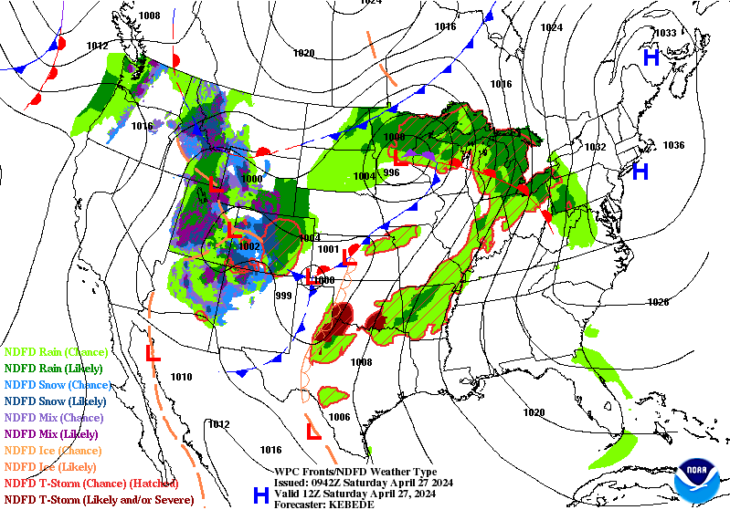
![]() by LargoFL Fri Apr 27, 2018 9:11 am
by LargoFL Fri Apr 27, 2018 9:11 am
LargoFL- Posts : 10724
Reputation : 130
Join date : 2017-03-05
Re: CLOSED April Showers
![]() by BillsfaninSoFla Fri Apr 27, 2018 10:26 am
by BillsfaninSoFla Fri Apr 27, 2018 10:26 am
BillsfaninSoFla- Posts : 1966
Reputation : 52
Join date : 2017-03-05
Re: CLOSED April Showers
![]() by PuppyToes Fri Apr 27, 2018 11:52 am
by PuppyToes Fri Apr 27, 2018 11:52 am

PuppyToes- Posts : 185
Reputation : 4
Join date : 2017-03-28
Re: CLOSED April Showers
![]() by LargoFL Fri Apr 27, 2018 1:06 pm
by LargoFL Fri Apr 27, 2018 1:06 pm
ok good luck Billsfan!!BillsfaninSoFla wrote:Good morning! Yes, the Palm Beach met said on radio that showers area likely. We shall see!
LargoFL- Posts : 10724
Reputation : 130
Join date : 2017-03-05
Re: CLOSED April Showers
![]() by LargoFL Fri Apr 27, 2018 1:06 pm
by LargoFL Fri Apr 27, 2018 1:06 pm
Hiya PT..you have a great weekend also!!PuppyToes wrote:I just wanted to pop in and say TGIF to everyone and here’s to another fabulous weekend!! A great weekend to barbecue and enjoy your favorite beverage!
LargoFL- Posts : 10724
Reputation : 130
Join date : 2017-03-05
Re: CLOSED April Showers
![]() by StPeteFLwx Fri Apr 27, 2018 1:15 pm
by StPeteFLwx Fri Apr 27, 2018 1:15 pm

StPeteFLwx- Posts : 351
Reputation : 20
Join date : 2017-03-17
Re: CLOSED April Showers
![]() by BillsfaninSoFla Fri Apr 27, 2018 6:01 pm
by BillsfaninSoFla Fri Apr 27, 2018 6:01 pm
BillsfaninSoFla- Posts : 1966
Reputation : 52
Join date : 2017-03-05
Page 13 of 15 • 1 ... 8 ... 12, 13, 14, 15 ![]()
» CLOSED 8-13-17 FLORIDA/ALABAMA WEATHER
» April-May Florida weather and local events etc
» CLOSED BLOG Florida Weather
» CLOSED Last Hurrah for March?
:: Florida Blog


» summer 2019 hurricane season
» April-May Florida weather and local events etc
» NASCAR 2019
» Late January through February outlook
» FLORIDA/ALABAMA AND THE HOLIDAY SEASON WEATHER
» NASCAR 2018
» CLOSED Florida/Alabama Blog - October Tropical Mischief