


CLOSED April Showers
:: Florida Blog
Page 11 of 15 •  1 ... 7 ... 10, 11, 12, 13, 14, 15
 ![]()
Re: CLOSED April Showers
![]() by JRnOldsmar Sun Apr 22, 2018 7:38 am
by JRnOldsmar Sun Apr 22, 2018 7:38 am
Off to Orlando again this morning. Just cleaning up some work now and hoping to get an early start.
Good luck on rain for everyone.

JRnOldsmar- Posts : 828
Reputation : 48
Join date : 2017-03-05
Location : Oldsmar, FL
Re: CLOSED April Showers
![]() by sangria Sun Apr 22, 2018 7:49 am
by sangria Sun Apr 22, 2018 7:49 am
I DID cash in, what a great evening - watching the race and rain coming down at a steady pace. Training set up and kept me in the sweet spot for quite a while last night. I had a couple good cracks of lightning/thunder that made me jump but other than that it was pretty limited.
Now, the difficult part - My gauge showed 2.24" when it finished. The surrounding PWSs, including the one in my sub had 3"+. The wind was blowing pretty good so I'm guessing I just didn't get it all in the gauge. With that said though, I'll have to stick with the 2.24" and not complain!

sangria- Admin
- Posts : 2345
Reputation : 55
Join date : 2012-07-16


StAugustineFL- Posts : 2231
Reputation : 64
Join date : 2012-07-17
Re: CLOSED April Showers
![]() by sangria Sun Apr 22, 2018 7:51 am
by sangria Sun Apr 22, 2018 7:51 am
sangria- Admin
- Posts : 2345
Reputation : 55
Join date : 2012-07-16
Re: CLOSED April Showers
![]() by sangria Sun Apr 22, 2018 7:53 am
by sangria Sun Apr 22, 2018 7:53 am
StAugustineFL wrote:Test:
Passed and that makes a nice animation Aug.
sangria- Admin
- Posts : 2345
Reputation : 55
Join date : 2012-07-16
Re: CLOSED April Showers
![]() by StAugustineFL Sun Apr 22, 2018 7:59 am
by StAugustineFL Sun Apr 22, 2018 7:59 am
StAugustineFL- Posts : 2231
Reputation : 64
Join date : 2012-07-17
Re: CLOSED April Showers
![]() by StAugustineFL Sun Apr 22, 2018 8:02 am
by StAugustineFL Sun Apr 22, 2018 8:02 am
sangria wrote:StAugustineFL wrote:Test:
Passed and that makes a nice animation Aug.
Yes, love the COD 200 frame loop! Been awhile since I tinkered with their page. That extended radar will be cool to look at over a 6+ hour period when the radar is active.
StAugustineFL- Posts : 2231
Reputation : 64
Join date : 2012-07-17
Re: CLOSED April Showers
![]() by BillsfaninSoFla Sun Apr 22, 2018 8:31 am
by BillsfaninSoFla Sun Apr 22, 2018 8:31 am
BillsfaninSoFla- Posts : 1966
Reputation : 52
Join date : 2017-03-05
Re: CLOSED April Showers
![]() by LargoFL Sun Apr 22, 2018 8:44 am
by LargoFL Sun Apr 22, 2018 8:44 am

LargoFL- Posts : 10724
Reputation : 130
Join date : 2017-03-05
Re: CLOSED April Showers
![]() by sangria Sun Apr 22, 2018 8:46 am
by sangria Sun Apr 22, 2018 8:46 am

sangria- Admin
- Posts : 2345
Reputation : 55
Join date : 2012-07-16
Re: CLOSED April Showers
![]() by LargoFL Sun Apr 22, 2018 8:48 am
by LargoFL Sun Apr 22, 2018 8:48 am
LargoFL- Posts : 10724
Reputation : 130
Join date : 2017-03-05

LargoFL- Posts : 10724
Reputation : 130
Join date : 2017-03-05
Re: CLOSED April Showers
![]() by LargoFL Sun Apr 22, 2018 9:42 am
by LargoFL Sun Apr 22, 2018 9:42 am
LargoFL- Posts : 10724
Reputation : 130
Join date : 2017-03-05
Re: CLOSED April Showers
![]() by BillsfaninSoFla Sun Apr 22, 2018 9:46 am
by BillsfaninSoFla Sun Apr 22, 2018 9:46 am
BillsfaninSoFla- Posts : 1966
Reputation : 52
Join date : 2017-03-05
Re: CLOSED April Showers
![]() by BillsfaninSoFla Sun Apr 22, 2018 9:47 am
by BillsfaninSoFla Sun Apr 22, 2018 9:47 am
BillsfaninSoFla- Posts : 1966
Reputation : 52
Join date : 2017-03-05
Re: CLOSED April Showers
![]() by LargoFL Sun Apr 22, 2018 10:44 am
by LargoFL Sun Apr 22, 2018 10:44 am
thanks Billsfan,hopefully some more later today,air is sure humid here..hopefully you will get some too..good luck okBillsfaninSoFla wrote:Congrats Largo on picking up some rain.
LargoFL- Posts : 10724
Reputation : 130
Join date : 2017-03-05
Re: CLOSED April Showers
![]() by LargoFL Sun Apr 22, 2018 10:45 am
by LargoFL Sun Apr 22, 2018 10:45 am
LargoFL- Posts : 10724
Reputation : 130
Join date : 2017-03-05
Re: CLOSED April Showers
![]() by LargoFL Sun Apr 22, 2018 10:47 am
by LargoFL Sun Apr 22, 2018 10:47 am
...High Risk of Rip Currents Palm Beaches...
...Scattered Thunderstorms With Locally Heavy Rain...
This hazardous weather outlook is for South Florida.
.DAY ONE...TODAY AND TONIGHT
Rip currents: There is a high risk of rip currents at the Palm
Beaches, and a moderate risk of rip currents at the Broward and
Miami-Dade beaches.
Thunderstorms: Scattered thunderstorms are forecast across the
western interior, Lake Okeechobee region, the Palm Beaches and the
adjacent coastal waters. Elsewhere, isolated thunderstorms are
possible across the remainder of South Florida and adjacent waters.
The primary threats will be lightning and brief heavy rain.
Waterspouts: There is a slight chance of waterspouts this morning
over the Atlantic waters.
Wind: Sustained winds locally near 20 knots will be possible over
the Gulf Stream this morning.
Flooding: Slow moving thunderstorms may produce heavy rain, causing
minor street flooding and ponding of water in areas of poor
drainage, over the east coast metro areas.
Waves: Wave heights locally up to 7 feet will be possible over the
Gulf Stream this morning.
.DAYS TWO THROUGH SEVEN...MONDAY THROUGH SATURDAY
Scattered thunderstorms will be possible at times Monday through
Tuesday evening, with the greatest risk from lightning and locally
heavy rain. Thunderstorms Tuesday may also be capable of producing
small hail, brief gusty winds, and waterspouts.
There is an elevated risk of rip currents continuing at the Atlantic
beaches Monday and potentially into Tuesday.
.SPOTTER INFORMATION STATEMENT...
Spotter activation is not anticipated, however individual spotters
are encouraged to report high wind, hail and flooding to the National
Weather Service forecast office in Miami.
For more information...visit the National Weather Service in
Miami website at www.weather.gov/miami.
$$
LargoFL- Posts : 10724
Reputation : 130
Join date : 2017-03-05
Re: CLOSED April Showers
![]() by PuppyToes Sun Apr 22, 2018 10:51 am
by PuppyToes Sun Apr 22, 2018 10:51 am

PuppyToes- Posts : 185
Reputation : 4
Join date : 2017-03-28
Re: CLOSED April Showers
![]() by BillsfaninSoFla Sun Apr 22, 2018 11:19 am
by BillsfaninSoFla Sun Apr 22, 2018 11:19 am
BillsfaninSoFla- Posts : 1966
Reputation : 52
Join date : 2017-03-05
BillsfaninSoFla- Posts : 1966
Reputation : 52
Join date : 2017-03-05
Re: CLOSED April Showers
![]() by PuppyToes Sun Apr 22, 2018 11:31 am
by PuppyToes Sun Apr 22, 2018 11:31 am
PuppyToes- Posts : 185
Reputation : 4
Join date : 2017-03-28
Re: CLOSED April Showers
![]() by LargoFL Sun Apr 22, 2018 11:31 am
by LargoFL Sun Apr 22, 2018 11:31 am
lol. good luck okBillsfaninSoFla wrote:Not that I’m greedy lol.
LargoFL- Posts : 10724
Reputation : 130
Join date : 2017-03-05

LargoFL- Posts : 10724
Reputation : 130
Join date : 2017-03-05
Re: CLOSED April Showers
![]() by LargoFL Sun Apr 22, 2018 11:32 am
by LargoFL Sun Apr 22, 2018 11:32 am
LargoFL- Posts : 10724
Reputation : 130
Join date : 2017-03-05
Re: CLOSED April Showers
![]() by LargoFL Sun Apr 22, 2018 11:35 am
by LargoFL Sun Apr 22, 2018 11:35 am
LargoFL- Posts : 10724
Reputation : 130
Join date : 2017-03-05
Re: CLOSED April Showers
![]() by LargoFL Sun Apr 22, 2018 11:38 am
by LargoFL Sun Apr 22, 2018 11:38 am
AFDJAX
Area Forecast Discussion
National Weather Service Jacksonville FL
925 AM EDT Sun Apr 22 2018
.UPDATE...
12Z sounding this morning showed dry air remaining above 700mb. A
band of showers was lifting northward across southeast Georgia,
otherwise, dry conditions prevailed. The surface warm front still
remained to the south of the region, and guidance is now
indicating that the boundary will not lift into the region until
very late in the afternoon or more likely this evening. Therefore,
guidance has backed off significantly on rainfall chances for
today, and cut rainfall chances further for the forecast today.
Isolated to scattered showers are still forecast to develop across
the region this afternoon. An isolated thunderstorm cannot be
ruled out across the southern fringes of the region, where
temperatures will rise into the lower 80s. Breezy easterly winds
will prevail, especially at the beaches, with gusts to 30-35 mph
possible. Temperatures are expected to continue to slowly
moderate, and bumped up temps a couple degrees due to more
sunshine expected today.
&&
LargoFL- Posts : 10724
Reputation : 130
Join date : 2017-03-05
Re: CLOSED April Showers
![]() by LargoFL Sun Apr 22, 2018 11:57 am
by LargoFL Sun Apr 22, 2018 11:57 am
Last edited by LargoFL on Sun Apr 22, 2018 12:58 pm; edited 1 time in total
LargoFL- Posts : 10724
Reputation : 130
Join date : 2017-03-05
Re: CLOSED April Showers
![]() by LargoFL Sun Apr 22, 2018 11:58 am
by LargoFL Sun Apr 22, 2018 11:58 am
Last edited by LargoFL on Sun Apr 22, 2018 12:59 pm; edited 1 time in total
LargoFL- Posts : 10724
Reputation : 130
Join date : 2017-03-05
Re: CLOSED April Showers
![]() by BillsfaninSoFla Sun Apr 22, 2018 12:36 pm
by BillsfaninSoFla Sun Apr 22, 2018 12:36 pm
BillsfaninSoFla- Posts : 1966
Reputation : 52
Join date : 2017-03-05
Re: CLOSED April Showers
![]() by LargoFL Sun Apr 22, 2018 1:00 pm
by LargoFL Sun Apr 22, 2018 1:00 pm
yeah im trying to get rid of them, some sities dont let you post their radars etc.BillsfaninSoFla wrote:The last two Largo posts are empty? At least for me
LargoFL- Posts : 10724
Reputation : 130
Join date : 2017-03-05
Re: CLOSED April Showers
![]() by LargoFL Sun Apr 22, 2018 1:02 pm
by LargoFL Sun Apr 22, 2018 1:02 pm
National Weather Service Miami FL
1238 PM EDT SUN APR 22 2018
FLZ067-068-168-221730-
Coastal Palm Beach County-Inland Palm Beach County-Metro Palm Beach
County-
1238 PM EDT SUN APR 22 2018
.NOW...
At 1235 PM EDT, Doppler radar indicated a large thunderstorm 8 miles
north of Lion Country Safari Park, moving north-northeast at 15 mph.
Additional showers and thunderstorms will continue to develop today.
Gusty wind, heavy rain, and frequent lightning, are the main threats
that can be expected from any of these thunderstorms.
Locations impacted include...
West Palm Beach, Jupiter, Palm Beach Gardens, Tequesta, Juno Beach,
North County Airport, The Acreage, Caloosa, Philo Farms, Jupiter
Farms and Limestone Creek.
LargoFL- Posts : 10724
Reputation : 130
Join date : 2017-03-05
Re: CLOSED April Showers
![]() by LargoFL Sun Apr 22, 2018 1:04 pm
by LargoFL Sun Apr 22, 2018 1:04 pm
National Weather Service Melbourne FL
1233 PM EDT Sun Apr 22 2018
AMZ550-552-555-570-572-575-FLZ041-044>047-053-054-058-059-064-141-
144-147-230445-
Flagler Beach to Volusia-Brevard County Line 0-20 nm-Volusia-
Brevard County Line to Sebastian Inlet 0-20 nm-
Sebastian Inlet to Jupiter Inlet 0-20 nm-Flagler Beach to Volusia-
Brevard County Line 20-60 nm-Volusia-
Brevard County Line to Sebastian Inlet 20-60 nm-
Sebastian Inlet to Jupiter Inlet 20-60 nm-Inland Volusia County-
Northern Lake County-Orange-Seminole-Southern Brevard County-
Osceola-Indian River-Okeechobee-St. Lucie-Martin-
Coastal Volusia County-Southern Lake County-
Northern Brevard County-
1233 PM EDT Sun Apr 22 2018
THIS HAZARDOUS WEATHER OUTLOOK IS FOR EAST CENTRAL FLORIDA.
.DAY ONE...THIS AFTERNOON AND TONIGHT.
.THUNDERSTORM IMPACT...
There will be a chance of lightning storms across east central
Florida this afternoon, especially west of I-95, as brisk east
southeast flow, increasing moisture and daytime heating combine
to destabilize the local airmass. The main hazard with any storms
will be cloud to ground lightning strikes, wind gusts up to 40
mph, and local heavy downpours.
LargoFL- Posts : 10724
Reputation : 130
Join date : 2017-03-05
Re: CLOSED April Showers
![]() by LargoFL Sun Apr 22, 2018 1:06 pm
by LargoFL Sun Apr 22, 2018 1:06 pm
LargoFL- Posts : 10724
Reputation : 130
Join date : 2017-03-05
Re: CLOSED April Showers
![]() by LargoFL Sun Apr 22, 2018 1:07 pm
by LargoFL Sun Apr 22, 2018 1:07 pm
National Weather Service Jacksonville FL
908 AM EDT Sun Apr 22 2018
AMZ470-472-474-222100-
/O.CON.KJAX.SC.Y.0026.000000T0000Z-180424T0900Z/
Waters from Altamaha Sound GA to Fernandina Beach FL from 20 to
60 NM-
Waters from Fernandina Beach to St. Augustine FL from 20 to 60 NM-
Waters from St. Augustine to Flagler Beach FL from 20 to 60 NM-
908 AM EDT Sun Apr 22 2018
...SMALL CRAFT ADVISORY REMAINS IN EFFECT UNTIL 5 AM EDT
TUESDAY...
* WINDS...East winds 20 to 25 knots with occasional gusts to 35
knots through tonight. Winds will become south southeast on
Monday.
* WAVES/SEAS...Seas 6 to 8 feet with occasional seas up to 10 feet
today. Seas 6 to 9 feet with occasional seas up to 11 feet tonight
into Monday.
PRECAUTIONARY/PREPAREDNESS ACTIONS...
A Small Craft Advisory means that wind speeds of 20 to 33 knots,
and/or seas 7 feet or higher, are expected to produce hazardous
conditions for small craft. Inexperienced boaters, especially
those operating smaller vessels should avoid navigating in these
conditions.
&&
$$
LargoFL- Posts : 10724
Reputation : 130
Join date : 2017-03-05
Re: CLOSED April Showers
![]() by LargoFL Sun Apr 22, 2018 1:11 pm
by LargoFL Sun Apr 22, 2018 1:11 pm
NWS Storm Prediction Center Norman OK
0227 AM CDT Sun Apr 22 2018
Valid 241200Z - 251200Z
...NO SEVERE THUNDERSTORM AREAS FORECAST...
...SUMMARY...
Thunderstorms are possible across portions of the southern Plains as
well as the Mid-Atlantic states and Florida Peninsula.
...Discussion...
A shortwave trough is expected to progress southeastward from the
central High Plains into the central/southern Plains. The movement
of this shortwave will encourage a southward surge of a cold
continental airmass into the southern Plains. Airmass ahead of the
front isn't expected to be particularly moist but enough instability
will likely exist to support thunderstorms. The stronger flow aloft
will lag behind the front and the current prospects for severe
thunderstorms during the afternoon and evening are low. Elevated
thunderstorms may develop overnight in response to an strengthening
low-level jet with the increased mid-level flow contributing to some
severe potential. However, current guidance is inconsistent on the
development of these storms and, even if they do develop,
instability will likely be quite limited.
Farther east, a mature cyclone is expected to move from central
KY/middle TN northeastward through the central Appalachians. At the
sane time, an attendant surface low will track northeastward through
the Mid-Atlantic states. Warm sector associated with this low will
be confined to the coastal areas of the Carolinas. A strong storm or
two is possible in this area as well as along and just north of the
warm front. However, anticipated low coverage and numerous
uncertainties inherent to forecasts at this range preclude
introducing any severe probabilities with this outlook.
Lastly, thunderstorms are anticipated across the central and
southern FL Peninsula as modest ascent, provided by both the
eastward progression of the cyclone mentioned above and a surface
trough traversing the region, interacts with the unstable airmass
over the area. A strong storm or two is possible during the
afternoon and severe probabilities may be needed in subsequent
outlooks if confidence in sufficient severe coverage increases.
..Mosier.. 04/22/2018
LargoFL- Posts : 10724
Reputation : 130
Join date : 2017-03-05
Re: CLOSED April Showers
![]() by LargoFL Sun Apr 22, 2018 1:13 pm
by LargoFL Sun Apr 22, 2018 1:13 pm
National Weather Service Tampa Bay Ruskin FL
948 AM EDT Sun Apr 22 2018
.UPDATE...
A nearly zonal flow is in place aloft this morning over the region
ahead of a cut-off low moving into the Lower Mississippi Valley. At
the surface, high pressure over the northeast extends south over
Florida, with an area of low pressure and associated cold front
moving into the deep south. Low-level wind flow across the region is
mostly from the southeast, with a scattering of showers and a few
thunderstorms over the east coast making their way over the interior.
These showers and storms will continue to make their way toward the
west coast through the day, and daytime heating will allow the sea
breeze to form this afternoon near the coast, so greatest shower and
thunderstorm coverage looks to be right along the I-75 corridor. This
is supported well by hi-res models and have made just some minor
tweaks in the ongoing forecast to reflect this thinking with no
major changes needed.
&&
LargoFL- Posts : 10724
Reputation : 130
Join date : 2017-03-05

LargoFL- Posts : 10724
Reputation : 130
Join date : 2017-03-05
Re: CLOSED April Showers
![]() by BillsfaninSoFla Sun Apr 22, 2018 1:48 pm
by BillsfaninSoFla Sun Apr 22, 2018 1:48 pm
BillsfaninSoFla- Posts : 1966
Reputation : 52
Join date : 2017-03-05
Re: CLOSED April Showers
![]() by LargoFL Sun Apr 22, 2018 3:16 pm
by LargoFL Sun Apr 22, 2018 3:16 pm
so far im not either billsfan geeBillsfaninSoFla wrote:I'm not invited to the party again. Lol
LargoFL- Posts : 10724
Reputation : 130
Join date : 2017-03-05
Re: CLOSED April Showers
![]() by LargoFL Sun Apr 22, 2018 3:17 pm
by LargoFL Sun Apr 22, 2018 3:17 pm
AMZ552-572-221930-
/O.NEW.KMLB.MA.W.0025.180422T1830Z-180422T1930Z/
BULLETIN - IMMEDIATE BROADCAST REQUESTED
Special Marine Warning
National Weather Service Melbourne FL
230 PM EDT SUN APR 22 2018
The National Weather Service in Melbourne has issued a
* Special Marine Warning for...
Volusia-Brevard County Line to Sebastian Inlet 0-20 nm...
Volusia-Brevard County Line to Sebastian Inlet 20-60 nm...
* Until 330 PM EDT
* At 229 PM EDT, strong thunderstorms were located along a line
extending from near Cocoa Beach to 17 nm east of Patrick Air Force
Base to 33 nm east of Sebastian Inlet State Park, moving north at
15 knots.
HAZARD...Wind gusts 34 knots or greater.
SOURCE...Radar indicated.
IMPACT...Expect wind gusts in excess of 34 knots...suddenly higher
waves...lightning and heavy downpours. Make sure all on
board are wearing life jackets. Return to safe harbor if
possible.
* Locations impacted include...
Jetty Park, Port Canaveral, Cape Canaveral, Cocoa Beach and Patrick
Air Force Base.
PRECAUTIONARY/PREPAREDNESS ACTIONS...
Move to safe harbor immediately as gusty winds and high waves are
expected.
&&
LAT...LON 2868 8032 2838 7977 2796 7978 2821 8026
2826 8066 2868 8081
TIME...MOT...LOC 1829Z 173DEG 16KT 2830 8059 2827 8027 2805 7986
HAIL...0.00IN
WIND...>34KTS
$$
Cristaldi
LargoFL- Posts : 10724
Reputation : 130
Join date : 2017-03-05
Re: CLOSED April Showers
![]() by LargoFL Sun Apr 22, 2018 3:19 pm
by LargoFL Sun Apr 22, 2018 3:19 pm
National Weather Service Miami FL
238 PM EDT Sun Apr 22 2018
FLZ066-069-070-075-222100-
Hendry-Coastal Collier-Inland Collier-Mainland Monroe-
Including the cities of Clewiston, LaBelle,
Big Cypress Seminole Reservation, Naples, Immokalee, and Flamingo
238 PM EDT Sun Apr 22 2018
.NOW...
Scattered thunderstorms will continue to affect inland portions
of Collier County through 5pm. The main threats with these storms
are frequent cloud to ground lightning, wind gusts to 30 mph and
heavy rainfall. Rainfall amounts of 1 to 2 inches are possible
with the heavier activity. The thunderstorms will be migrating
very slowly toward the northeast as the afternoon progresses. Some
locations that may be impacted by these thunderstorms include
Alligator Alley in central and eastern Collier County, Immokalee
and Ave Maria.
$$
Hagen
LargoFL- Posts : 10724
Reputation : 130
Join date : 2017-03-05
Re: CLOSED April Showers
![]() by LargoFL Sun Apr 22, 2018 4:22 pm
by LargoFL Sun Apr 22, 2018 4:22 pm
National Weather Service Miami FL
413 PM EDT SUN APR 22 2018
FLZ063-066-070-222100-
Hendry FL-Inland Collier County FL-Glades FL-
413 PM EDT SUN APR 22 2018
...SIGNIFICANT WEATHER ADVISORY FOR NORTHWESTERN HENDRY COUNTY UNTIL
500 PM EDT...
* At 413 PM EDT, Doppler radar was tracking a strong thunderstorm 7
miles east of Felda, or 12 miles northeast of Immokalee, moving
north at 10 mph.
* Dime size hail and winds in excess of 45 mph will be possible with
this storm.
* Locations impacted include...
Labelle, Montura, Port La Belle, Devils Garden and Keri.
LAT...LON 2646 8123 2657 8150 2680 8141 2669 8106
TIME...MOT...LOC 2013Z 182DEG 11KT 2656 8131
$$
JT
LargoFL- Posts : 10724
Reputation : 130
Join date : 2017-03-05
Re: CLOSED April Showers
![]() by LargoFL Sun Apr 22, 2018 4:24 pm
by LargoFL Sun Apr 22, 2018 4:24 pm
LargoFL- Posts : 10724
Reputation : 130
Join date : 2017-03-05
Re: CLOSED April Showers
![]() by LargoFL Sun Apr 22, 2018 4:26 pm
by LargoFL Sun Apr 22, 2018 4:26 pm
.NOW...
...Showers & Isolated Thunderstorms Continue This Afternoon...
A stationary front across Lake Okeechobee will continue to produce
numerous showers and isolated thunderstorms in east central Florida
this afternoon. Current radar shows strong thunderstorms just south
of Cape Canaveral and along the Treasure Coast and Okeechobee
county. Some storms will be capable of producing gusty winds of 40
to 50 mph, heavy downpours, and frequent lightning.
To the north, steady coastal showers move onshore Volusia county,
with isolated thunderstorms possible. Breezy onshore flow persists
along the coast with hazardous boating conditions and rough surf
expected.
$$
$$
LargoFL- Posts : 10724
Reputation : 130
Join date : 2017-03-05
Re: CLOSED April Showers
![]() by LargoFL Sun Apr 22, 2018 4:31 pm
by LargoFL Sun Apr 22, 2018 4:31 pm
LargoFL- Posts : 10724
Reputation : 130
Join date : 2017-03-05
Re: CLOSED April Showers
![]() by LargoFL Sun Apr 22, 2018 4:32 pm
by LargoFL Sun Apr 22, 2018 4:32 pm
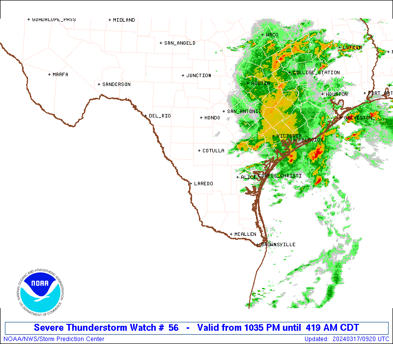
URGENT - IMMEDIATE BROADCAST REQUESTED
Tornado Watch Number 56
NWS Storm Prediction Center Norman OK
255 PM CDT Sun Apr 22 2018
The NWS Storm Prediction Center has issued a
* Tornado Watch for portions of
Southeast Alabama
Florida Panhandle
Southwest Georgia
Coastal Waters
* Effective this Sunday afternoon and evening from 255 PM until
900 PM CDT.
* Primary threats include...
A few tornadoes possible
Scattered damaging wind gusts to 70 mph possible
SUMMARY...Scattered showers and thunderstorms will overspread the
watch area this afternoon, with a few of the storms becoming severe
with isolated tornadoes and damaging wind gusts possible.
The tornado watch area is approximately along and 50 statute miles
east and west of a line from 50 miles northeast of Troy AL to 70
miles southwest of Panama City FL. For a complete depiction of the
watch see the associated watch outline update (WOUS64 KWNS WOU6).
PRECAUTIONARY/PREPAREDNESS ACTIONS...
REMEMBER...A Tornado Watch means conditions are favorable for
tornadoes and severe thunderstorms in and close to the watch
area. Persons in these areas should be on the lookout for
threatening weather conditions and listen for later statements
and possible warnings.
&&
AVIATION...Tornadoes and a few severe thunderstorms with hail
surface and aloft to 1 inch. Extreme turbulence and surface wind
gusts to 60 knots. A few cumulonimbi with maximum tops to 450. Mean
storm motion vector 20035.
...Hart
LargoFL- Posts : 10724
Reputation : 130
Join date : 2017-03-05
Re: CLOSED April Showers
![]() by LargoFL Sun Apr 22, 2018 4:35 pm
by LargoFL Sun Apr 22, 2018 4:35 pm

LargoFL- Posts : 10724
Reputation : 130
Join date : 2017-03-05
Re: CLOSED April Showers
![]() by LargoFL Sun Apr 22, 2018 4:37 pm
by LargoFL Sun Apr 22, 2018 4:37 pm
ALC067-222045-
/O.NEW.KTAE.TO.W.0015.180422T2022Z-180422T2045Z/
BULLETIN - EAS ACTIVATION REQUESTED
Tornado Warning
National Weather Service Tallahassee FL
322 PM CDT SUN APR 22 2018
The National Weather Service in Tallahassee has issued a
* Tornado Warning for...
Northwestern Henry County in southeastern Alabama...
* Until 345 PM CDT.
* At 322 PM CDT, a severe thunderstorm capable of producing a tornado
was located near Richards Crossroads, or near Abbeville, moving
northeast at 20 mph.
HAZARD...Tornado.
SOURCE...Radar indicated rotation.
IMPACT...Flying debris will be dangerous to those caught without
shelter. Mobile homes will be damaged or destroyed.
Damage to roofs, windows, and vehicles will occur. Tree
damage is likely.
* This tornadic thunderstorm will remain over mainly rural areas of
northwestern Henry County, including the following locations...
Otho, Scottsboro Crossroads, Double Bridges, Lawrenceville,
Screamer and Thomas Mill Creek.
PRECAUTIONARY/PREPAREDNESS ACTIONS...
TAKE COVER NOW! Move to a basement or an interior room on the lowest
floor of a sturdy building. Avoid windows. If you are outdoors, in a
mobile home, or in a vehicle, move to the closest substantial shelter
and protect yourself from flying debris.
&&
LAT...LON 3169 8512 3161 8531 3167 8537 3171 8535
3170 8522 3171 8521 3174 8521 3175 8519
3175 8518
TIME...MOT...LOC 2022Z 222DEG 16KT 3165 8530
TORNADO...RADAR INDICATED
HAIL...0.00IN
$$
30-PULLIN
LargoFL- Posts : 10724
Reputation : 130
Join date : 2017-03-05
Re: CLOSED April Showers
![]() by LargoFL Sun Apr 22, 2018 4:39 pm
by LargoFL Sun Apr 22, 2018 4:39 pm
LargoFL- Posts : 10724
Reputation : 130
Join date : 2017-03-05
Page 11 of 15 • 1 ... 7 ... 10, 11, 12, 13, 14, 15 ![]()
» CLOSED Florida Regions 3 Day Forecast
» CLOSED Thick of Summer in Florida!
» April-May Florida weather and local events etc
» CLOSED Last Hurrah for March?
:: Florida Blog


» summer 2019 hurricane season
» April-May Florida weather and local events etc
» NASCAR 2019
» Late January through February outlook
» FLORIDA/ALABAMA AND THE HOLIDAY SEASON WEATHER
» NASCAR 2018
» CLOSED Florida/Alabama Blog - October Tropical Mischief